Sunday, September 25, 2016

A Hike to Aviation Tragedy on Mt. Humphreys


The San Francisco Peaks Near Flagstaff, Arizona

It was in the early hours of September 15th, 1944 when Second Lieutenant Warren E. Crowther was piloting his TB-24J aircraft (aka a B-24 bomber) with seven other personnel aboard: 4 student pilots, 2 engineers and a radio operator. The plane had taken off from Kirtland Field in New Mexico and headed out for a nighttime training flight scheduled to return later to Albuquerque. This was the plane’s and occupants’ last flight. All men aboard died when pilot error caused the plane to fly directly into the side of Arizona's highest peak, Mt. Humphreys.

B-24 Bomber
The remains of the B-24 airship have resided on the western side of the Mt. Humphreys for over seventy years. But the plane is not alone. Amazingly, a second plane crash occurred just a few days after this crash on Sept. 18, 1944. A B-17 Flying Fortress crashed on the opposite side of the mountain near Bear Jaw Canyon, killing four soldiers. Only a year earlier on March 5, 1943, another B-17 crashed into the northeast side of nearby Mt. Elden. An R4D-8 Gooneybird plane, crashed on Mt. Humphreys on Jan. 21, 1943. Finally, B-18 Bolo plane crashed in these volcanic mountains on Oct. 2, 1941. Truly, the 1940s were not good years for aviation in the San Francisco Peaks.

Mt. Elden
I have lived at the southern base of Mt. Elden all summer and will have spent over sixty working days this summer (nearly every weekend) hiking and driving around Mt. Humphreys and the other San Francisco peaks. Yet, in that time I haven't had the success in visiting the crash site. I finally succeeded on September 25th when I spent six hours hiking to the elusive B-24 crash site. I was its solitary visitor this day.


As a federally protected historical site, any unmanaged visitation to it the site can result in the loss of historical integrity. People have built badly designed social trails to the site, stolen historical artifacts, and otherwise altered the location and appearance of objects found there. I’m posting the GPS coordinates to the closest plane artifacts below with the sincere wish that visitors respect this historical military site and show some sensitivity to the fact that our military personnel lost their lives here during their service to country.

Hiking to the crash site is very dangerous. The one incomplete social trail to the site is steep, barely able to be followed, and very difficult to traverse. Only a few hard-to-locate rock cairns mark the route. Once one get to the GPS coordinate provided, more crash debris can probably be found easiest by just proceeding north, perpendicular the volcanic scree field fall line.

While the site is than a third of a mile from the main Humphreys Trail, it takes about an hour to safely get there.  It should not be attempted alone and it is inadvisable to ever take children to the location. One must pass over seemingly endless lava scree fields. It is just far too easy to trip, fall on sharp and tipsy volcanic boulders, drop into deep holes between rocks, and sprain or break ankles.
I fell several times.


Fuselage and Instrumentation Strewn Down the Lava Scree Field
From the Humphreys Peak trailhead the hike to the crash site is about 7.2 miles long, round trip, has a rated difficulty of 4.3 out of 5, and requires an ascent a of more than 2,100 feet to an elevation of over 11,000 feet.

Looking West, Tattered US Flag on Log Inserted Into Upside Down B-24 Landing Gear
The views from the site to the west are magnificent. Over 20 miles away can be seen Williams Peak. Kendrick Mountain is seen to the right, and numerous volcanic cinder cones and ancient volcanoes are viewable across the verdant valley. Off to the north nearly 100 miles away can be seen the north rim of the Grand Canyon. During the fall changing of the aspen leaves color, nature’s complexity, danger, and majesty are on full display.
Remains of Bomber Gun Turret


GPS Coordinates:

  • N 35° 20.455 W 111° 41.389
  • 12S E 437314 N 3911068


Saturday, September 24, 2016

Hopi Reservation Petroglyph Tour


At the end of August I accompanied the Interpretive Partnership volunteers from the Flagstaff, AZ area National Monuments on a day trip to the Hopi Reservation. At its center is Kykotsmovi Village (K-Town), home to the Hopi Cultural Center and the sovereign nation’s government complex.

We received an extensive tour of the Dawa Park site consisting of a cliff face more than a half-mile long filled with 15,000 images. You need a permit or guide to visit sites such as this. Dawa is believed to be the second-largest concentration of petroglyphs in the country. It may possibly contain 15,000 sandstone carvings. Sensory overload was the meme of the day.

The images provide a complex overview of the lives of ancestral Pueblo Indians who carved the petroglyphs as far back as 2,000 years ago. Not all the carvings are that well understood even by natives or academicians that study the images and their many possible interpretations. Readers might want to consult this interpretation of Hopi petroglyph writing/art.

Below are some of the photographs I took of the carvings. For a better sense of the topography and scope of the site, you should visit this virtual tour of the Dawa site.


Everywhere you walk in the site a fragments of ancient pottery from the time of habitation. Natives collect some of the shards and place them on display on one of the large display boulders. These cultural artifacts are not to ever be removed.


After the cliff tour we visited the Hopi cultural center, had an authentic Hopi family meal, and looked over the many exquisite Hopi crafts on sale, in particular the Kachina dolls

For more information about Hopi cultural center and government operations I suggest visiting the official website of Hopi Nation.


Friday, September 23, 2016

The Kachina Trail

The Kachina Peaks Wilderness near Flagstaff, Arizona affords the outdoor enthusiast ample opportunities to explore nature by car, bicycle, horse, foot and snowshoe. One of the nicest trails in the wilderness near where I’ve been volunteering this summer at Mt. Humphreys is the Kachina Trail. The moderately strenuous trail is a 5.2 mile segment passing around the south side of Agassiz Peak at an elevation of about 9,000 feet.

I hiked the Kachina Trail in mid-September out from the western trailhead for a distance of about three miles to where there is a great view southward to the city of Flagstaff resting at about 7,000 feet. The aspen tree leaves were only just starting to yellow due to the first hard frost on the mountain. The bracket ferns had all started to brown and the annual cycle of life was present everywhere.

The trail gradually descends with a few welcome grade changes to keep things interesting and your knees from experiencing the constant impact of stepping downward. 

The violence of the mountains creation is present in the form of occasional cliffs formed by volcanic action when these San Francisco Peaks were forged as a stratovolcano nearly 400,000 years ago. 

If you study the rock face one can readily descent the various strata of lava flows. Lower on the mountain there exist lava tube caves created by rapidly cooling surface crusts of fast flowing magma.


The trail resides in the largest Ponderosa Pine (Pinus ponderosa subsp. brachyptera) forest in the nation. It is interspersed with the Aspen trees that have difficulty establishing significantly sized stands due to the high canopy of the Ponderosas. Only through lightning caused fires would the aspen find the opportunity to reestablish themselves in this environment. Through the use of prescribed forest fire burns or timber thinning projects by the US Forest Service have the aspen a chance to prosper.  Evidence of nature's fire is evident along the trail where openings have been created for natural plant succession to occur.

Fire exposes the rocky and volcanic pumice strewn surface where new plants have difficulty taking a root hold on a very porous surface,

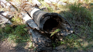
Where trees have died and allowed to slowly decompose they build moisture retaining moisture to allow grasses, flowers, and fungi to prosper. Big plants give birth to new life.


The rock, themselves often speed the tree decomposition by cleaving the trunks as they strike the ground with enormous force.


The trees do fight back by tenaciously clinging to rock outcroppings for many hundreds of years and dropping their seeds into the rock crevices to encourage the next generation of growth.


Thursday, September 22, 2016

My Summer of PSAR Draws To A Close, 2016

Bob and Mt. Humphreys
 in the Distance
My summer stint with the US Forest Service as a volunteer "Roving Ranger"is soon coming to an end and I will be transitioning to new volunteer duties in the Flagstaff, AZ area. (Itinerary below)

Since I've written extensively lately about Search and Rescue, I won't dwell on the summer's activities again other than to say its been fun, educational, and rewarding. For the most part all the volunteers and NPS and Forest Service staff I've had the privilege of working with have been great. The more I explore and volunteer, the more opportunities that seem to present themselves.

Every year the names of the Forest Service seasonal volunteers are carved into wood signs for posterity to revere with awe and gratitude <g>. Nearly twenty years of these panels hang in the wood shop. Somehow the sign makers managed to remember my name this year. Some volunteers are long-time, repeat offenders returning for more than a decade of service.

One sideline activity of my PSAR work this season is that I have been giving weekly talks to sixth graders at the Flagstaff Unified School District's summer facility: Camp Colton. The SAR team is seeking to modify the PSAR curriculum based on Hug A Tree and Survive that us normally geared to 10-14 year old students. The goal is to modify it for both kindergarten level students (never too early to learn survival tactics) and high school students. We hope to produce and distribute nationally a new video on the revised curriculum. 

Besides the PSAR work, I've also been involved with the Interpretive Partnership, a joint project of the Forest Service, National Park Service, and other local agencies dedicated to providing educational and recreational services to the public
Every week the 20+ volunteer members in the partnership provide guided walking tours of cultural and natural resources in the three Flagstaff area national monuments (Walnut Canyon, Wupatki, and Sunset Crater Volcano) and at other regional trails of significance; campground talks, stargazing sessions, nature walks, and more. We also serve as roving rangers on Mount Agassiz at the top of Arizona Snowbowl where we describe the landmarks and history of  100 mile+ viewable area.

Walnut Canyon Trail Cliff  Dwellings
In exchange for volunteering the partnership agencies provide RV sites and extensive continuing professional education opportunities. Nearly every week we benefited from some scientist or other expert providing us custom talks or field trips to historical or scientifically important sites in the region.

For example, we visited rarely accessible petroglyph sites in the Zuni Nation, saw hidden, ancient pueblo ruins, were lectured about ongoing archaeological investigations, shown photo collections from Flagstaff's Lowell Observatory about recent satellite flybys of Pluto System and the Keuper Belt using NASA’s New Horizons spacecraft, and much more, The Pluto images we saw were trypically only accessible by project scientists for their research work.

Due to my work with both the Preventative Search and Rescue Program (PSAR) and Coconino County SAR team I'm now serving as an adviser to a Northern Arizona University Wilderness Studies program. The class is charged with developing several research products this semester. The two I'm working with address designing:

  1. Better delivery methods of PSAR training for a target audience of high school students.
  2. A digital communication package (web portal of smartphone application) to prepare visitors for hiking in the Kachina Wilderness using Humphreys Trail. The trail leads to the highest summit in Arizona. 
Yes, it's been a busy summer, but the seasons change.

In less than a month, on or about October 18th 2016, if circumstances don't change, my core PSAR duties on Mt. Humphreys will end and I will transition to a new volunteer opportunity at nearby Walnut Canyon National Monument. I will trade in my green US Forest Service uniform for the grey, green, and brown of a National Park Service Ranger (Smokey Bear hat and all. Woohoo!)

I will move Toad Haul Manor to the monument compound and attempt to survive a Flagstaff winter's snow at 7,000 feet. I will work out of the visitor center providing interpretive services: giving talks and guided tours of the ancient pueblo dwellings last occupied in the 1200's, explaining the special ecological and archaeological features of the canyon, and staffing the visitor center answering questions and selling monument related publications and other educational products.

Walnut Canyon In Winter After a Heavy Snowfall

I'm not done with SAR work. SAR missions will continue this winter when the emphasis will shift to avalanche safety concerns in the mountains. 

In February, I will transition to yet a different location that I will describe to you'all later this winter. 

Until then, please stay tuned. The Toad Haul Manor adventures will continue.